Along the Coastal Recreational Path ...
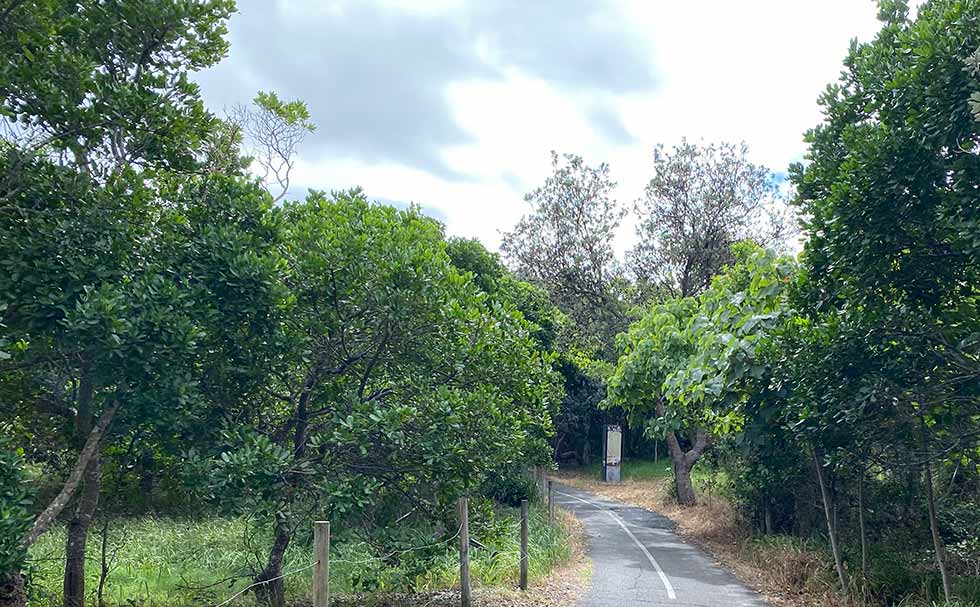
Thanks to decades of bush regeneration work along the back of Angels and Sharpes beaches, an abundance of natural life is returning to these places.
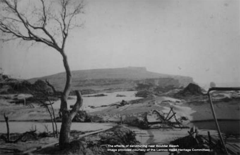
Across the period from the 1890s to the 1960s mining of middens for shell lime and sandmining destroyed the dune systems at the rear of the beaches.
Today the community is working to regenerate the area’s native bushland and carefully protect such cultural artefacts as were able to survive the damaging decades across the first half of the 20th century.
The stories in the sign
The scroll through section below presents the information contained in the sign on site at this interpretive node.
As well as allowing you to explore this material again, it means that non-English speaking visitors and others not easily able to read the signs can connect with this content via their mobile devices. Adjust your internet browser settings to activate translation and/or text-to-speech options.
Mining and changes in landscape
Sand mining had a significant impact upon the coastline between Ballina and Lennox Head and the destruction of Aboriginal sites both through the mining of rutile itself and through the construction of infrastructure to support the industry.
Specifically, road and bridges which were needed for access to the areas to be mined. Small scale sand mining took place as early as the 1870s, but it was between the 1950s and 1970s that large-scale operations were active.
This was particularly at Flat Rock, south of Sharpes Beach and behind Boulder Beach.
When the Lennox Head-Sharpes Beach district was made more accessible by sand mining operations, which was large-scale from the 1950s, both locations became popular recreational and tourist destinations.
Ballina and Lennox Head have developed into urbanised ‘sea-change’ destinations, and more recently urban development is especially prevalent in the Skennars Head district.
Companies that mined the Kingscliff coast were Porter and Dereck, Cudgen RZ, New South Wales Mining Co., Associated Minerals, and Titanium & Zircon Industries.
By the 1970s the mining deposits had become exhausted, and operations were wound up in the area. Although disturbed landscapes can be traumatic for Aboriginal people and reminders of the destruction of cultural heritage they remain culturally active landscapes.
In the video below Uncle Lewis Cook speaks of connections to Country and of the significance of these places for the local community.
Cabbage Tree Island Community
Just as the natural environment of this area has been dramatically impacted by European settlement, so too have Aboriginal people been forced to adapt to radical change.
Cabbage Tree Island located some 20km upstream in the Richmond River provided a base from which the community could still maintain its connections to Country.
Cabbage Tree Island provides an important focal point for community connection.
In the recording here Uncle Lewis describes how as children they used to make the long trip up the estuary to Cabbage Tree Island by using the tides and improvised sails to help them along.
As well the stories recorded specifically for this project, the local community values a selection of historical recordings that speak of community life around Cabbage Tree Island.
One of these is a recording with Uncle Douglas 'Duck' Cook from 1983. Here he speaks of how the community adapted to life on the island by growing sugar cane to bring in an income to supplement their reliance on local bush tucker food harvested from the estuary.